Difference between revisions of "Maps/Town"
< Maps
Jump to navigation
Jump to search
m |
|||
| Line 1: | Line 1: | ||
| − | {{Map/Start|base=Town-Aerial. | + | {{Map/Start|base=Town-Aerial.jpg|width={{{width|1000}}}}} |
<!--{{Map/Grid|color=rgba(255, 255, 255, 0.5)}}--> | <!--{{Map/Grid|color=rgba(255, 255, 255, 0.5)}}--> | ||
{{Map/Label|22|56|[[5 Dogwood Drive]]|length=25|width=6}} | {{Map/Label|22|56|[[5 Dogwood Drive]]|length=25|width=6}} | ||
Latest revision as of 11:45, 21 July 2023
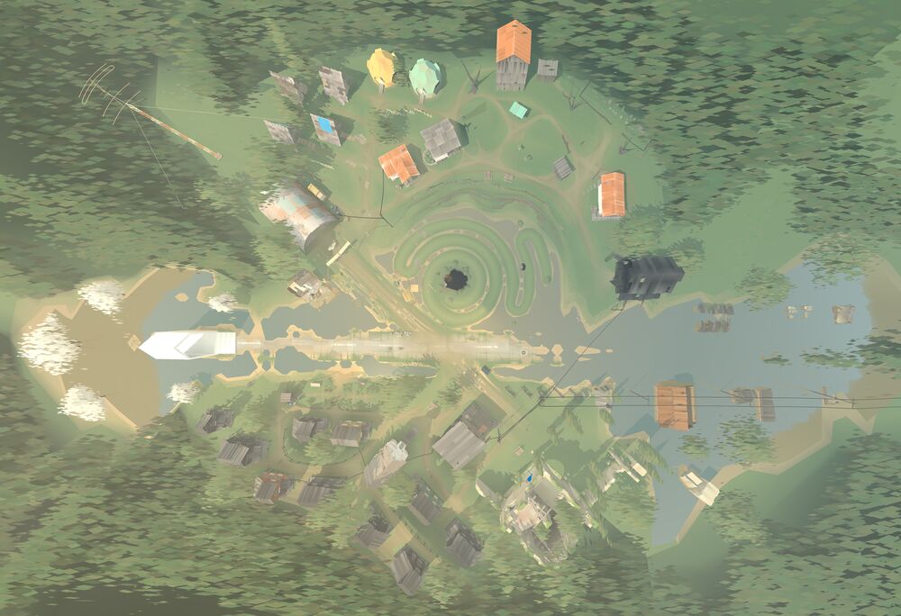
Hangar
Old church
Library
Barn
Graveyard
Bell tower
Cafe/Company Store
Garden
Small cave
Mail stop